
Archives
Enter a word or phrase to perform a general search across all records in the Archives catalog. You can also browse records in the catalog without performing a search.
Search Tips
- Searches are not case sensitive.
- Searching for multiple words connects them with OR by default. Matching records can contain any of the words.
- Connect multiple words with AND if you only want to see records containing both words.
- Use quotation marks to search for a phrase.
- Place an asterisk (*) at the end of a word as a wildcard.
2903 results found. Records searched: 2903
-

-
-
-
-
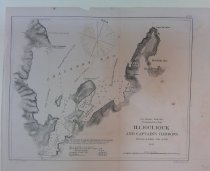
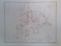
ILLIOuLIOUK AND CAPTAIN'S HARBORS, UNALASKA ISLAND 1869. - Chart, Navigational
PS2025.4.116
Record Type: Archive
-
-
-
-
Inland Passage between Sitka Harbor and Hoonah Sound, S.E. Alaska - Chart, Navigational
PS2025.4.336
Record Type: Archive
-
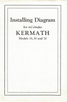
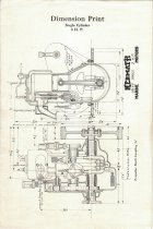
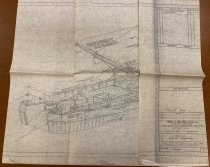
Installing Diagram for 4-Cylinder Kermath Models 35, 50 and 70 - Booklet, Instruction
PS2017.1.2
Record Type: Archive
-
Installing Diagram for 6-Cylinder Kermath Model 150 - Booklet, Instruction
PS2017.1.4
Record Type: Archive
-
Installing Diagram for 6-Cylinder Kermath Models 65 and 80 - Booklet, Instruction
PS2017.1.3
Record Type: Archive
-
Instruction Book No. 32A-2 for Installing and Operating Atlas Imperial Four Cycle Mechanical Injection Diesel Engines - Booklet, Instruction
PS2017.18.12
Record Type: Archive
-
-
-
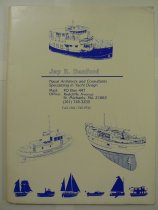
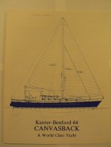
Jay R. Benford: Naval Architects and Consultants Specializing in Yacht Design - Folder, File
PS2015.18.1.1
Record Type: Archive
-
Johnstone and Broughton Straits and Queen Charlotte Sound (1867) - Chart, Navigational
PS2025.4.43
Record Type: Archive
-
-
-
-
-
Keku Strait, Monte Carlo Island to Entrance Island - Chart, Navigational
PS2025.4.186
Record Type: Archive
-
Kelp, Takatz and Warm Spring Bays, Chatham Strait, Alaska - Chart, Navigational
PS2025.4.358
Record Type: Archive
-
-
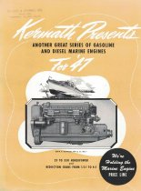
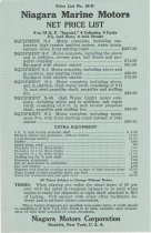
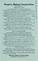
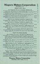
Kermath Presents Another Great Series of Gasoline and Diesel Marine Engines for '47 - Brochure
PS2017.1.9
Record Type: Archive
-
-
-
-
-
-
-
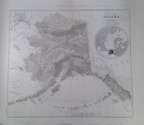
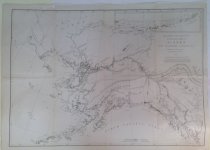
Kroll's Standard Map of the Territory of Alaska - Chart, Navigational
PS2025.4.96
Record Type: Archive
-
-
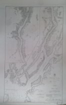
LYNN CANAL AND STEPHENS PASSAGE, S.E. ALASKA (1914) - Chart, Navigational
PS2025.4.380
Record Type: Archive
-
LYNN CANAL AND STEPHENS PASSAGE, S.E. ALASKA (Part of Chart) - Chart, Navigational
PS2025.4.47
Record Type: Archive
-
LYNN CANAL, from Point Sherman to Head (1908) - Chart, Navigational
PS2025.4.378
Record Type: Archive
-
Lake Bay and Approaches, Clarence Strait. ALASKA - Chart, Navigational
PS2025.4.65
Record Type: Archive
-
Lake Bay and Approaches, Clarence Strait. ALASKA - Chart, Navigational
PS2025.4.233
Record Type: Archive
-
-
-
Leschi Lakecafe & G.B.B. Bar Announces the Return of Capt. Frank Gilbert Last of the Great Lake Washington Steamer Skippers - Release, News
PS2016.9.113
Record Type: Archive
-
Leschi Lakecafe & G.B.B. Bar Announces the Return of Capt. Frank Gilbert Last of the Great Lake Washington Steamer Skippers - Release, News
PS2016.9.114
Record Type: Archive
-
-
-
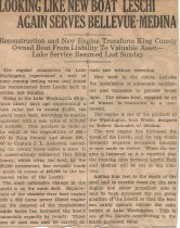
Looking Like New Boat LESCHI Again Serves Bellevue-Medina - Newspaper
PS2016.9.223
Record Type: Archive
-
Los Angeles and Long Beach Harbors Rangefinder and Compass Testing (1935) - Chart, Navigational
PS2025.4.170
Record Type: Archive
-
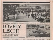
Lovely Leschi: The cable car brought town folks to a resort of lake-side pleasures - Newspaper
PS2016.9.49
Record Type: Archive
-
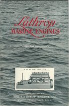
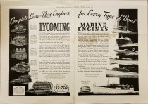
Lycoming Marine Engines: Complete Line of New Engines for Every Type of Boat - Ad, Magazine
PS2017.1.37
Record Type: Archive
-
-
Lynn Canal From Pt. Sherman to Head of Inlet (1898) - Chart, Navigational
PS2025.4.132
Record Type: Archive
-
-
-
-
-
-
-
-
-
-
-
-
-
-
-
-
M/V HYAK and Class 382' Puget Sound Ferries M/V ELWHA, O.N. 512 324 - Stability - Letter
PS2016.9.135
Record Type: Archive
-
MAP OF ALASKA SHOWING THE AREA DISTURBED BY SENSIBLE SHOCKS DURING THE EARTHQUAKES OF SEPTEMBER, 1899 IN AND AROUND YAKUTAT BAY - Chart, Navigational
PS2025.4.102
Record Type: Archive
-
MARCO Standard Specifications for Vessels Designed and Built By Marine Construction and Design Co. - Booklet
PS2017.5.8
Record Type: Archive
-
-
-
Map Showing Location and Extent of Kelp Groves on Frederick Sound and Sumner Strait, S.E. Alaska - Chart, Navigational
PS2025.4.21
Record Type: Archive
-
Map Showing Location and Extent of Kelp Groves on Lynn Canal and Stevens Passage, S.E. Alaska - Chart, Navigational
PS2025.4.20
Record Type: Archive
-
Map Showing the Distribution of the Native Tribes of Alaska and Adjoining Territory, Compiled from the latest authorities By W. H. Dall, U. S. Coast Survey, 1875. - Chart, Navigational
PS2025.4.101
Record Type: Archive
-
-
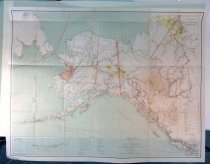
Map of Alaska Compiled from the Official Records of the General Land Office, U.S. Coast & Geodetic Survey, Canadian and other sources, under the Direction of Harry King, C. E., Chief of Drafting Division G.L.O. 1898. - Chart, Navigational
PS2025.4.98
Record Type: Archive
-
Map of Alaska and Adjoining Regions, Showing the Distribution of Native Tribes, Compiled by Ivan Petroff Special Agent Tenth Census 1880 - Chart, Navigational
PS2025.4.197
Record Type: Archive
-
-
Map of Lewis and Clark's Track Acrofs the Western Portion of North America from the Mississippi to the Pacific Ocean…1804, 5, and 6 (Oregon Historical Society Reprint) - Chart, Navigational
PS2025.4.268
Record Type: Archive
-
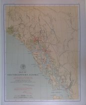
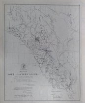
Map of Southeastern Alaska Showing Locations of Principal Indian Villages, as fixed by Lieut. G.T. Emmons, U.S.N. - Chart, Navigational
PS2025.4.97
Record Type: Archive
-
Map of Southeastern Alaska Showing Locations of Principal Indian Villages, as fixed by Lieut. G.T. Emmons, U.S.N. - Chart, Navigational
PS2025.4.278
Record Type: Archive
-
Map of the Klondike Region on the Upper Yukon, & Canada (clipped from The World; see reverse) - Chart, Navigational
PS2025.4.103
Record Type: Archive
-
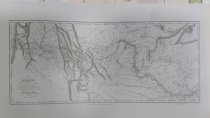
Map of the Oregon Territory, by the U.S. Ex. Ex. 1841 (No. 135) - Chart, Navigational
PS2025.4.38
Record Type: Archive
-
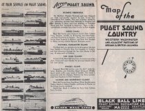
Map of the Puget Sound Country: Western Washington and Adjacent Portions of Oregon & British Columbia - Brochure
PS2017.1.112
Record Type: Archive
-
Map of the State of Oregon and Washington Territory (1981 reprint by Oregon Historical Society) - Chart, Navigational
PS2025.4.271
Record Type: Archive
-
-
-
-
-
-
Marco Misc. Aleutian Spray photo, publicity photo list, Marco hull number/client list, incomplete hull number list (Marco?) - Booklet
PS2017.5.18
Record Type: Archive
-
-
-
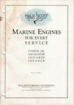
Marine Engines for Every Service: Fisher Jr., Navigator, Explorer, Invader - Booklet
PS2017.1.32
Record Type: Archive
-
-
-

-
-
-
-
Metlakatla Ferry Design Notebook: 50% Complete Review Submittal - Documents
PS2018.2.10
Record Type: Archive
-
-
-
Model Experiments in support of the design of a 73.5-foot boat for the Puget Sound Pilots - Documents
PS2018.2.15
Record Type: Archive
-
Model Experiments to Investigate High Stabilizer Fin Drag on the Yachtfisher "Spears Sea II" - Documents
PS2018.2.14
Record Type: Archive
-
Model Tests of a 100-Foot Yachtfisher Designed by Ed Monk - Documents
PS2018.2.1
Record Type: Archive
-
Model Tests of a 102-foot Motor Yacht Designed by Ewin Monk & Son, Inc for the Nordlund Boat Company, Inc - Documents
PS2018.2.13
Record Type: Archive
-
-
Model Tests of a 78.8-foot Motor Yacht for Nordlund Boat Co - Documents
PS2018.2.3
Record Type: Archive
-
Model Tests of an 86-foot Motor Yacht Designed by Edwin Monk & Son Naval Architects - Documents
PS2018.2.7
Record Type: Archive
-
Model Tests to Assess Hydrodynamic Aspects of a Bulbous Bow Retrofit Proposed for a 75-foot Motor Yacht - Documents
PS2018.2.11
Record Type: Archive
-
Model experiments in support of the design of a 64-foot long range coastal cruiser - Documents
PS2018.2.17.1
Record Type: Archive
-
Model experiments in support of the design of a 92-foot motor yacht for Mr. Stephen L. Way, Esq. - Documents
PS2018.2.19
Record Type: Archive
-
-
Modern Lubrication and Fuel Requirements for Diesel Engines - Booklet
PS2017.1.89
Record Type: Archive
-
-
N.E. PT. OF TEXADA ISLAND TO JOHNSTONE STRAIT, BRITISH COLUMBIA. - Chart, Navigational
PS2025.4.42
Record Type: Archive
-
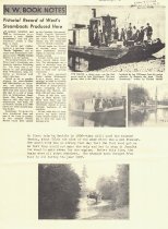
N.W. Book Notes: Pictorial Record of West's Steamboats Produced Here - Documents
PS2016.9.57
Record Type: Archive
-
N.W. Shore of Portland Inlet, Alaska Surveyed by Lt. H.E. Nichols, U.S.N. - Chart, Navigational
PS2025.4.122
Record Type: Archive
-
NORTHWEST COAST OF AMERICA, SHEET No. 1, Cape Flattery to DIXON ENTRANCE 1868 - Chart, Navigational
PS2025.4.204
Record Type: Archive
-
NORTHWEST COAST OF AMERICA, SHEET No. 1, Cape Flattery to DIXON ENTRANCE 1868 - Chart, Navigational
PS2025.4.406
Record Type: Archive
-
NORTHWEST COAST OF AMERICA, SHEET No. 2, DIXON ENTRANCE TO CAPE St. ELIAS 1868 - Chart, Navigational
PS2025.4.381
Record Type: Archive
-
NORTHWEST COAST OF AMERICA, SHEET No. 2, DIXON ENTRANCE TO CAPE St. ELIAS 1868 - Chart, Navigational
PS2025.4.408
Record Type: Archive
-
NORTHWEST COAST OF AMERICA, SHEET No. 2, DIXON ENTRANCE TO CAPE St. ELIAS 1868 - Chart, Navigational
PS2025.4.281
Record Type: Archive
-
NORTHWEST COAST OF AMERICA, SHEET No. 2, DIXON ENTRANCE to CAPE ST. ELIAS 1868 - Chart, Navigational
PS2025.4.204.1
Record Type: Archive
-
-
-
-
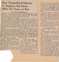
New Streamlined Mercer to Replace the Dawn After 22 Years on Run - Newspaper
PS2016.9.110
Record Type: Archive
-
-
-
-
-
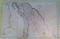
North America - West Coast Alaska Yukon River to Point Barrow including Bering Strait (1909) - Chart, Navigational
PS2025.4.109
Record Type: Archive
-
North America West Coast Reconnaissances in the Waters on the S.W. Coast of Alaska. By Lieut. F.M. Symonds, of the U.S. Ship Jamestown, Comdr. Henry Glass,U.S.N. Comdg. 1880. [Lynn Canal, Chilcat and Chilcoot Inlet. Schulze Cove. Fritz Cove. Hoonyah - Chart, Navigational
PS2025.4.282
Record Type: Archive
-
North Pacific Ocean N.W. Coast of America Anchorages and Passages in the Waters on the S.W. Coast of Alaska. From Reconnaissances by Master G.C. Hanus of the U.S. Ship Jamestown, Comdr. L.A. Beardslee. 1880. [Willoughby Cove, Whitestone Narrows, Wm. He - Chart, Navigational
PS2025.4.114
Record Type: Archive
-
North West Coast of America Dixon Entrance to Cape St. Elias (1912) - Chart, Navigational
PS2025.4.129
Record Type: Archive
-
North West Coast of America, Sheet No. 1: Cape Flattery to Dixon Entrance - Chart, Navigational
PS2025.4.203
Record Type: Archive
-
North West Coast of America, Sheet No. 1: CAPE FLATTERY TO DIXON ENTRANCE - Chart, Navigational
PS2025.4.342
Record Type: Archive
-
North West Coast of America, Sheet No. 3: Icy Bay to Seven Islands - Chart, Navigational
PS2025.4.405
Record Type: Archive
-
North West Coast of America, Sheet No. 3: Icy Bay to Seven Islands - Chart, Navigational
PS2025.4.407
Record Type: Archive
-
North West Coast of America, Sheet No. 3: Icy Bay to Seven Islands - Chart, Navigational
PS2025.4.128
Record Type: Archive
-
North West Coast of America, Sheet No. 3: Icy Bay to Seven Islands - Chart, Navigational
PS2025.4.205
Record Type: Archive
-
-
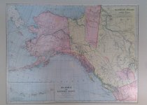
North western America Showing the Territory Ceded by Russia to the United States - Chart, Navigational
PS2025.4.325
Record Type: Archive
-

-

-

-
-
-
-
-
-
-
Official Report, Economy and Maneuvering Trials of the Single Screw Cargo Liner SS JAPAN MAIL, Marad Design C4-S-1s, Turbine Propulsion - Documents
PS2019.2.2
Record Type: Archive
-
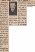
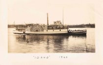
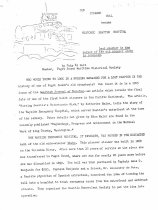
Old Steamer Hull Became Historic Seattle Hospital: Last Chapter in the Career of the Old Steamer Idaho is Revealed - Documents
PS1980.2.392.11
Record Type: Archive
-
-
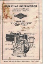
Operating Instructions: Adjustment and Repair Instructions, Parts List - Booklet
PS2017.1.76
Record Type: Archive
-
-
-
PLAN OF THE ENTRANCE OF THE PORT OF BUCARELLI ON THE NORTH WEST COAST OF AMERICA ... DISCOVERED IN 17775 BY THE SPANISH SCHOONER LA SENORA COMMANDED BY D. JUAN FCO. DE LA QUADRA & D. FRANCo. ANTo. MAURELLE; AND MORE AMPLY EXPLORED IN TH E EXPEDITION OF 1 - Chart, Navigational
PS2025.4.92
Record Type: Archive
-
-
-
-
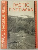
Pacific Fisherman Annual Statistical Number: the organ of the commercial fisheries of the Pacific - Yearbook
PS2021.4.85
Record Type: Archive
-
Pacific Fisherman Annual Statistical Number: the organ of the commercial fisheries of the Pacific - Yearbook
PS2021.4.86
Record Type: Archive
-
Pacific Fisherman Statistical Number: the organ of the commercial fisheries of the Pacific - Yearbook
PS2021.4.93
Record Type: Archive

-
Pacific Fisherman Statistical Number: the organ of the commercial fisheries of the Pacific - Yearbook
PS2021.4.94
Record Type: Archive
-
Pacific Fisherman Statistical Number: the organ of the commercial fisheries of the Pacific - Yearbook
PS2021.4.87
Record Type: Archive
-
Pacific Fisherman Statistical Number: the organ of the commercial fisheries of the Pacific - Yearbook
PS2021.4.88
Record Type: Archive
-
Pacific Fisherman Statistical Number: the organ of the commercial fisheries of the Pacific - Yearbook
PS2021.4.89
Record Type: Archive
-
Pacific Fisherman Statistical Number: the organ of the commercial fisheries of the Pacific - Yearbook
PS2021.4.90
Record Type: Archive
-
Pacific Fisherman Statistical Number: the organ of the commercial fisheries of the Pacific - Yearbook
PS2021.4.92
Record Type: Archive

-
Pacific Fisherman Statistical Number: the organ of the commercial fisheries of the Pacific - Yearbook
PS2021.4.95
Record Type: Archive
-
Pacific Fisherman Statistical Number: the organ of the commercial fisheries of the Pacific - Yearbook
PS2021.4.91
Record Type: Archive
-
-
-
-
-
-
-
-
-
-
-
-
-
-
-
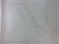
Part 1 of the Map of the Route of The Alaska Military Reconnaisance of 1883, Liet. Fredk Schwatka, Commander. - Chart, Navigational
PS2025.4.59
Record Type: Archive
-
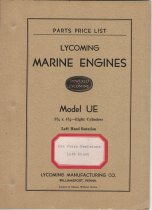
Parts Price List Model "UH" 3-1/16 x 4-3/4 Also Model "UHE" 3-5/32 x 4-3/4 Racing Type Six Cylinder Marine Engines - Booklet
PS2017.1.35
Record Type: Archive
-
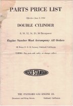
Parts Price List: Double Cylinder 8, 10, 12, 16, 20, 30 Horsepower - Booklet
PS2017.1.77
Record Type: Archive
-
-
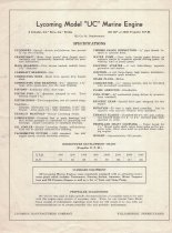
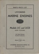
Parts Price List: Lycoming Marine Engines Models UC and UCD Eight Cylinders - Booklet
PS2017.1.34.1
Record Type: Archive
-
Peril Strait Hooniah Sound to Chatham Strait - Chart, Navigational
PS2025.4.365
Record Type: Archive
-
Peril Strait, Salisbury Sound to Hooniah Sound - Chart, Navigational
PS2025.4.366
Record Type: Archive
-
-
Photo Collection of Sailing Vessels by Captain Hudson H. ("Windy") Morrison. [SFMHP has negatives] - Chart, Navigational
PS2025.4.383ref
Record Type: Archive
-
Physical Model Tests of a 47' Planing Hull with a 5' Long Variable Angle Stern Extension - Documents
PS2018.2.4
Record Type: Archive
-
-
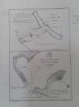
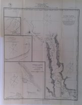
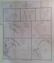
Plan of the Port des Francais on the North West Coast of America in 58 degrees 37 minutes Latitude North and 139 degrees 50 minutes of Longitude West, Discovered nd. July 1786, by the Boussole & Astrolabe. - Chart, Navigational
PS2025.4.91
Record Type: Archive
![Port de Francais [Lituya Bay, AK], 1798](https://s3.amazonaws.com/pastperfectonline/images/museum_899/024/thumbs/ps2025491.jpg)