Archives
Enter a word or phrase to perform a general search across all records in the Archives catalog. You can also browse records in the catalog without performing a search.
Search Tips
- Searches are not case sensitive.
- Searching for multiple words connects them with OR by default. Matching records can contain any of the words.
- Connect multiple words with AND if you only want to see records containing both words.
- Use quotation marks to search for a phrase.
- Place an asterisk (*) at the end of a word as a wildcard.
2903 results found. Records searched: 2903
-
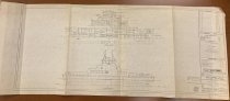
Plans & Specifications with Material List and Complete Instructions for Building - Blueprint
PS2014.1.16.4
Record Type: Archive

-
Plans & Specifications with Material List and Complete Instructions for Building - Blueprint
PS2014.1.16.3
Record Type: Archive
-
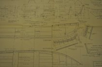
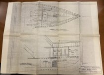
Plans for 92' harbor tugboat for Wilmington Transportation Co.: Clearance Sections - Blueprint
PS2023.7.9.2
Record Type: Archive
-
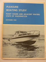
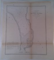
Pleasure Boating Study: Puget Sound and Adjacent Waters by the State of Washington - Book
PS2015.18.5
Record Type: Archive
-
Plenty Marine Steam Engines: Modern Economy Triple Expansion and Compound Types - Booklet
PS2017.18.15
Record Type: Archive

-

-
-
-
-
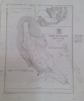
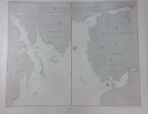
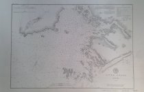
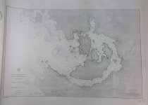
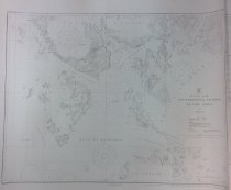
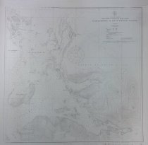
Port Simposon and Adjacent Anchorages, British Columbia, Canada - Chart, Navigational
PS2025.4.248
Record Type: Archive
-
-
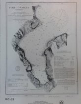
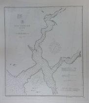
Port Townsend Washington [Bicentennial reprint 23] - Chart, Navigational
PS2025.4.27
Record Type: Archive
-
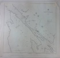
Ports Orchard and Madison including the inlets and passages between them in Admiralty Inlet, Oregon Territory. No. 156 - Chart, Navigational
PS2025.4.33
Record Type: Archive
-
-
-
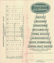
Powered by Lycoming: Skiffs, Cruisers, Commuters, Runabouts, Work Boats, Auxiliaries, Racing Hydroplanes, Custom Built Yachts - Brochure
PS2017.1.36
Record Type: Archive
-
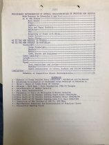
Preliminary Determination of Characteristics of Proposed New Vessels - Documents
PS2019.2.13
Record Type: Archive
-
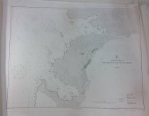
Preliminary Survey of the Mouth of the Columbia River Oregon Territory (1850) (photographic reprint) - Chart, Navigational
PS2025.4.267
Record Type: Archive
-
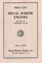
Price List Regal Marine Engines: Applying to Catalog No. 20 - Brochure
PS2017.1.73
Record Type: Archive
-
-
-
-
-
-
-
-
-
-
-
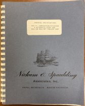
Proposal documents for a 494 ft. combination passenger/automobile roll-on roll-off ferry - Document
PS2023.7.6
Record Type: Archive
-
-
-
-
-
Pybus Bay, Admiralty Island Hobart and Windham Bays - Chart, Navigational
PS2025.4.212
Record Type: Archive
-
Pybus Bay, Admiralty Island Hobart and Windham Bays - Chart, Navigational
PS2025.4.361
Record Type: Archive
-
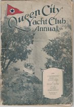
Queen City Yacht Club Annual: 1928 A Reference Book for Yachtsmen of Puget Sound and the Pacific Northwest - Book, Reference
PS2017.1.91
Record Type: Archive
-
-
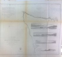
RECONNAISSANCE OF WESTern COAST OF THE UNITED STATES (Northern Sheet) from Umpquah River to the Boundary - Chart, Navigational
PS2025.4.24
Record Type: Archive
-
RECONNAISSANCE OF WESTern COAST OF THE UNITED STATES (Northern Sheet) from Umpquah River to the Boundary - Chart, Navigational
PS2025.4.461
Record Type: Archive
-
-
-
-
-
-
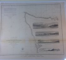
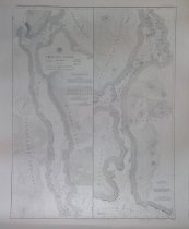
Reconnaissance of the western coast of the United States, from Gray's Harbor to the entrance of Admiralty Inlet - Chart, Navigational
PS2025.4.12
Record Type: Archive
-
Reconnaissance of the western coast of the United States, from Gray's Harbor to the entrance of Admiralty Inlet - Chart, Navigational
PS2025.4.85
Record Type: Archive
-
-
-
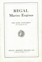
Regal Marine Engines: New Model Supplement for Catalog No. 20 - Booklet
PS2017.1.72
Record Type: Archive
-
Report on Complete Breakdown of Port Engine on Survey Craft Phyllis Bamsu - Memorandum
PS00.2018.34.2
Record Type: Archive
-
-
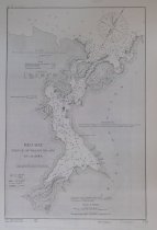
Revillagigedo Channel; Southeast Alaska (1936) - Chart, Navigational
PS2025.4.17
Record Type: Archive
-
-

-
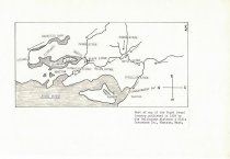
Route Map Juneau to Porcupine River, Alaska 1898 - Chart, Navigational
PS2025.4.25
Record Type: Archive
-
Russian chart of The N.W. Coast, from Cook Inlet to California. In Russian with French and English annotations (reprinted in the Alaska Boundary Tribunal 1903) - Chart, Navigational
PS2025.4.262
Record Type: Archive
-
-
-
-
-
-
-
-
-
-
SS WASHINGTON MAIL - Survey - No. 2 and No. 4 Main Deck Hatch Covers - Documents
PS2019.2.25
Record Type: Archive
-
-
-
-
-
-
San Diego Entrance and Approaches; San Diego Bay and Los Coronados - Chart, Navigational
PS2025.4.269
Record Type: Archive
-
San Diego to Bering Sea and Hawaiian Islands (North Pacific) - Chart, Navigational
PS2025.4.261
Record Type: Archive
-
-
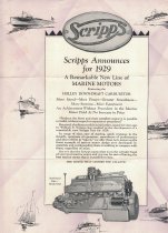
Scripps Announces for 1929 A Remarkable New Line of Marine Motors - Brochure
PS2017.1.67
Record Type: Archive
-
-

-
-
-
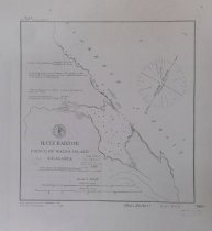
Seal Cove, Nichols Passage and Head of Kasaan Bay, Clarence Strait - Chart, Navigational
PS2025.4.323
Record Type: Archive
-
-
-

-
-
-
-
-
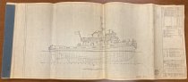
Ship plans for Wilmington Transportation Co. 105' Tugboat - Blueprint
PS2023.7.1
Record Type: Archive
-
-
-
-
-
-
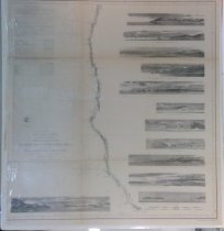
Showing the Progress of the Survey in Section No. XI, From Tillamook bay to the Boundary - Chart, Navigational
PS2025.4.22
Record Type: Archive

-
Showing the Progress of the Survey in Section No. XI, From Tillamook bay to the Boundary - Chart, Navigational
PS2025.4.23
Record Type: Archive
-
-
-

-
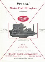
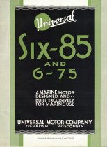
Six-85 and 6-75: A Marine Motor Designed and Built Exclusively for Marine Use - Booklet
PS2017.1.18
Record Type: Archive
-

-
Sketch Showing the Progress of the Surveys Locating the Boundary between Alaska and British Posessions in North America - Chart, Navigational
PS2025.4.285
Record Type: Archive
-
-
Sketch of the Harbor of Samganooda on the Island of Oonalaska - Chart, Navigational
PS2025.4.6
Record Type: Archive
-
-
-
-
-
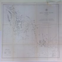
South Coast of Alaska, Bristol Bay, Nushagak Bay and Approaches - Chart, Navigational
PS2025.4.69
Record Type: Archive
-
South Coast of Alaska, Cross Sound to Yakutat Bay - Chart, Navigational
PS2025.4.259
Record Type: Archive
-
South Coast of Alaska, Cross Sound to Yakutat Bay - Chart, Navigational
PS2025.4.74
Record Type: Archive
-
South Coast of Alaska, Kenai Peninsula, Cape Resurrection to Two Arm Bay - Chart, Navigational
PS2025.4.71
Record Type: Archive
-
South Coast of Alaska, Kodiak Island, Sitkinak Strait and Alitak Bay - Chart, Navigational
PS2025.4.70
Record Type: Archive
-
-
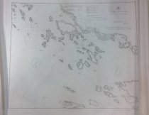
Southeast Alaska Baker, Noyes and Lulu Islands - Chart, Navigational
PS2025.4.219
Record Type: Archive
-
Southeast Alaska Baker, Noyes and Lulu Islands - Chart, Navigational
PS2025.4.151
Record Type: Archive
-
Southeast Alaska Baranof Island Crawfish Inlet to Sitka (1943) - Chart, Navigational
PS2025.4.207
Record Type: Archive
-
Southeast Alaska Baranof Island Crawfish Inlet to Sitka (1948) - Chart, Navigational
PS2025.4.190
Record Type: Archive
-
-
Southeast Alaska Central Dall Island and Vicinity (1944) - Chart, Navigational
PS2025.4.183
Record Type: Archive
-
-
-
-
-
-
Southeast Alaska Glacier Bay (1942) DUPLICATE - Chart, Navigational
PS2025.4.73
Record Type: Archive
-
-
-
-
-
-
-
-
-
Southeast Alaska Lynn Canal Entrance to Point Sherman (1934) - Chart, Navigational
PS2025.4.213
Record Type: Archive
-
Southeast Alaska Lynn Canal Entrance to Point Sherman, with subchart Funter Bay, (shows wire drag surveys) - Chart, Navigational
PS2025.4.255
Record Type: Archive
-
Southeast Alaska Lynn Canal from Entrance to Point Sherman, with subcharts of Fritz Cove, Swanson Harbor, and William Henry Bay, all on a scale of 1:20,000 (1916) - Chart, Navigational
PS2025.4.379
Record Type: Archive
-
Southeast Alaska Lynn Canal from Icy Strait to Point Sherman, with subcharts of Hawk Inlet and Funter Bay, all on a scale of 1:20,000 - Chart, Navigational
PS2025.4.246
Record Type: Archive
-
Southeast Alaska Patterson Bay and Deep Cove - Chart, Navigational
PS2025.4.161
Record Type: Archive
-
Southeast Alaska Peril Strait Hoonah Sound to Chatham Strait (1933) - Chart, Navigational
PS2025.4.168
Record Type: Archive
-
Southeast Alaska Peril Strait, Sitka Sound to Salisbury Sound - Chart, Navigational
PS2025.4.79
Record Type: Archive
-
Southeast Alaska Peril Strait, Sitka Sound to Salisbury Sound - Chart, Navigational
PS2025.4.367
Record Type: Archive
-
-
Southeast Alaska Port Snettisham, Stephens Passage - Chart, Navigational
PS2025.4.319
Record Type: Archive
-
-
Southeast Alaska Ports of Alexander, Conclusion and Armstrong - Chart, Navigational
PS2025.4.155
Record Type: Archive
-
Southeast Alaska San Christoval Channel to Cape Lynch - Chart, Navigational
PS2025.4.331
Record Type: Archive
-
Southeast Alaska Sitka Harbor and Approaches - Chart, Navigational
PS2025.4.369
Record Type: Archive
-
Southeast Alaska Sitka Sound to Salisbury Sound - Chart, Navigational
PS2025.4.187
Record Type: Archive
-
Southeast Alaska Snipe Bay to Crawfish Inlet - Chart, Navigational
PS2025.4.159
Record Type: Archive
-
-
Southeast Alaska Stephens Passage to Cross Sound - Chart, Navigational
PS2025.4.160
Record Type: Archive
-
-
-
-
Southeast Alaska West Coast of Prince of Wales Island Ulloa Channel to San Christoval Channel (1917) - Chart, Navigational
PS2025.4.329
Record Type: Archive
-
Southeast Alaska West Coast of Prince of Wales Island Ulloa Channel to San Christoval Channel (1932) - Chart, Navigational
PS2025.4.256
Record Type: Archive
-
Southeast Alaska West Coast of Prince of Wales Island Ulloa Channel to San Christoval Channel 1932 - Chart, Navigational
PS2025.4.175
Record Type: Archive
-
Southeast Alaska Wrangell Harbor and Highfield Anchorage - Chart, Navigational
PS2025.4.68a
Record Type: Archive
-
-
-
Southeast Alaska Yakobi Island & Lisianski Inlet - Chart, Navigational
PS2025.4.218
Record Type: Archive
-
Southeast Alaska Zarembo Island and Approaches - Chart, Navigational
PS2025.4.171
Record Type: Archive
-
Southeast Alaska - British Columbia, Portland Inlet to Nakat Bay - Chart, Navigational
PS2025.4.188
Record Type: Archive
-
Southeast Alaska - Coronation Island to Lisianski Strait - Chart, Navigational
PS2025.4.189
Record Type: Archive
-
Southeast Alaska - Coronation Island to Lisianski Strait - Chart, Navigational
PS2025.4.226
Record Type: Archive
-
Southeast Alaska - Portland Canal, Dixon Entrance to Hattie Island - Chart, Navigational
PS2025.4.258
Record Type: Archive
-
Southeast Alaska - Prince of Wales Island, Shakan and Shipley Bays and Part of El capitan Passage - Chart, Navigational
PS2025.4.250
Record Type: Archive
-
Southeast Alaska Hecate Strait to Etolin Island including Behm and Portland Canals - Chart, Navigational
PS2025.4.18
Record Type: Archive
-
Southeast Alaska Midway Islands to Cape Spencer including Lynn Canal (1942) - Chart, Navigational
PS2025.4.184
Record Type: Archive
-
-
Southeast Alaska Sitka Harbor and Approaches - Chart, Navigational
PS2025.4.194
Record Type: Archive
-
Southeast Alaska South and West Coasts of Kruzof Island 1943 - Chart, Navigational
PS2025.4.166
Record Type: Archive
-
Southeast Alaska South and West Coasts of Kruzof Island 1943 - Chart, Navigational
PS2025.4.235
Record Type: Archive
-
Southeast Alaska South and West Coasts of Kruzof Island 1943 - Chart, Navigational
PS2025.4.234
Record Type: Archive
-
Southeast Alaska Yakobi Island and Lisianski Inlet - Chart, Navigational
PS2025.4.167
Record Type: Archive
-
Southeast Alaska Zarembo Island and Approaches (1931) - Chart, Navigational
PS2025.4.148
Record Type: Archive
-
Southeast Alaska, Baranof Island, Snipe Bay to Crawfish Inlet - Chart, Navigational
PS2025.4.215
Record Type: Archive
-
Southeast Alaska, Chatham Strait, Port Malmsbury - Chart, Navigational
PS2025.4.242
Record Type: Archive
-
Southeast Alaska, Chatham Strait, Port Walter (wire drag surveys shown) - Chart, Navigational
PS2025.4.216
Record Type: Archive
-
Southeast Alaska, Chatham Strait, Whitewater Bay and Chaik Bay - Chart, Navigational
PS2025.4.222
Record Type: Archive
-
Southeast Alaska, Chatham Strait, Whitewater Bay and Chaik Bay - Chart, Navigational
PS2025.4.370
Record Type: Archive
-
Southeast Alaska, Eastern Part of Behm Canal - Chart, Navigational
PS2025.4.245
Record Type: Archive
-
Southeast Alaska, Hood Bay and Kootznahoo Inlet - Chart, Navigational
PS2025.4.224
Record Type: Archive
-
Southeast Alaska, Hood Bay and Kootznahoo Inlet - Chart, Navigational
PS2025.4.244
Record Type: Archive
-
Southeast Alaska, Lynn Canal, Point Sherman to Skagway - Chart, Navigational
PS2025.4.77
Record Type: Archive
-
Southeast Alaska, Salisbury Sound and Peril Strait to Emmons Island - Chart, Navigational
PS2025.4.260
Record Type: Archive
-
Southeast Alaska, South End of Prince of Wales Island, Kendrick Bay to Shipwreck Point - Chart, Navigational
PS2025.4.231
Record Type: Archive
-
Southeast Alaska, West Coast of Baranof Island, Cape Ommaney to Byron Bay - Chart, Navigational
PS2025.4.221
Record Type: Archive
-
Southeast Alaska, West Coast of Baranof Island, Cape Ommaney to Byron Bay - Chart, Navigational
PS2025.4.217
Record Type: Archive
-
-
-
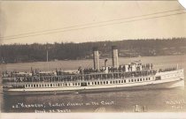
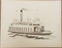
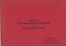
Souvenir of Columbia River Excursion on the Steamer Bailey Gatzert - Holder, Document
PS00.2019.1.2
Record Type: Archive
-
-
-
-
Specifications for the MARCO 35m x 9m Sardine purse seiner for PHs. VAN OMMEREN N.V. Rotterdam Spec. no. E102-208-1 Specifications for thr MARCO 35m x 9m Sardine purse seiner - Booklet
PS2017.5.1
Record Type: Archive
-
Specifications for the Marco 59" combination fishing vessel E 253-1 Specifications for thr MARCO 35m x 9m Sardine purse seiner - Booklet
PS2017.5.2
Record Type: Archive
-
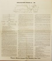
Specifications for the construction of a 120 ft. ferry - Documents
PS2023.7.2.2
Record Type: Archive
-
Specifications: 65' Steel Tow Boat, Young Brothers, Ltd. - Booklet, Instruction
PS2017.1.126
Record Type: Archive