
Archives
Enter a word or phrase to perform a general search across all records in the Archives catalog. You can also browse records in the catalog without performing a search.
Search Tips
- Searches are not case sensitive.
- Searching for multiple words connects them with OR by default. Matching records can contain any of the words.
- Connect multiple words with AND if you only want to see records containing both words.
- Use quotation marks to search for a phrase.
- Place an asterisk (*) at the end of a word as a wildcard.
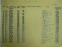
2903 results found. Records searched: 2903
-
-

-
-
-
-
-
-
-
-
-
-
-
-
-
-
-
-
-
-
-
-
-
-
-
-
-
-
-
-
-
-
-
-
-
-
-
-
-
-

-
-
-
-
-
-
-
-
-
-
-
-
-
-
-
-
-
-
-
-
-
-
-
-
-
-

-
-
-

-
-
-
-
-
-
-

-
-
-
-
-
-
-
-
-
-
-
-
-
-

-
-
-
-

-
-
-
-
-
-
-
-
-
-

-
-
-
-
-
-
-
-

-
-
-
-
-
-
-
-
-
-
-
-
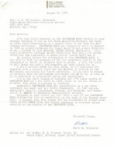
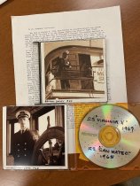
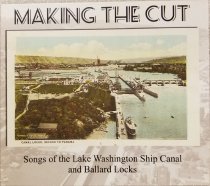
"Making the Cut: Songs of the Lake Washington Ship Canal and Ballard Locks" - Disc, Compact
PS2017.16.1
Record Type: Archive
-
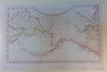
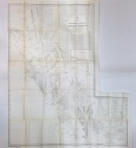
"TO THE RIGHT HONORABLE THE LORDS COMISSIONERS FOR EXECUTING THE OFFICE OF LORD HIGH ADMIRAL OF GREAT BRITIAN, THIS CHART OF THE NORTHWEST COAST OF AMERICA, WITH THE TRACKS OF THE KING GEORGE AND QUEEN CHARLOTTE IN 1786 & 1787. INSCRIBED BY THEIR LORDSH - Chart, Navigational
PS2025.4.196
Record Type: Archive
-
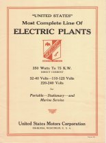
"United States" Most Complete Line of Electric Plants" - Brochure
PS2017.1.47.1
Record Type: Archive
-
-
-
1871 Coast Survey Progress Chart, Section X (Tomales Bay to Oregon Line) and Section XI (California Line to Tillamook Bay. - Chart, Navigational
PS2025.4.409
Record Type: Archive
-
1871 Coast Survey Progress Chart, Section X, San Diego to Point Sal. - Chart, Navigational
PS2025.4.410
Record Type: Archive
-
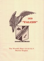
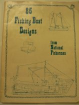
1929 'Falcon': The Most Advanced 10-15 H.P. Marine Engine - Booklet
PS2017.1.39
Record Type: Archive
-
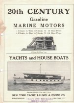
20th Century Gasoline Marine Engines: Yachts and House Boats - Brochure
PS2017.1.81
Record Type: Archive
-
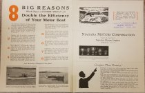
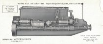
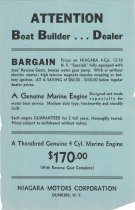
8 Big Reasons Why the Niagara 4-Cylinder 'Special' will Double the Efficiency of Your Motor Boat - Brochure
PS2017.1.25
Record Type: Archive
-
-
8L-8M, 8 cyl 135 and 155 HP Supercharged L8S-170 HP, 8MS 200HP - Insert, Paper
PS2017.1.26.4
Record Type: Archive
-
-
A CHART OF THE NTH. WEST COAST OF AMERICA & THE NTH. EAST COAST OF ASIA, SHEWING THE DISCOVERIES THAT HAVE BEEN LATELY IN THESE PARTS. Engraved by E. Gridley, Boston. - Chart, Navigational
PS2025.4.56
Record Type: Archive
-
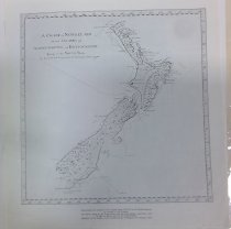
A Chart of Newzeland or the Island of Aeheinomouwe and Tovypoenammu, Lying in the Sound Sea. By Lieut. J. .Cook. Commander of the Endeavour Bark 1770 - Chart, Navigational
PS2025.4.266
Record Type: Archive
-
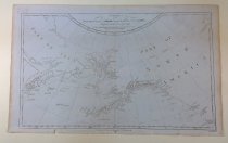
A Chart of the North West Coast of America & North East Coast of Asia Explored in 1778 & 79 The Unshaded parts of the coast of asia are taken from a M.S. chart received from the Russians. - Chart, Navigational
PS2025.4.286
Record Type: Archive
-
A Chart of the North West Coast of America & North East Coast of Asia Explored in 1778 & 79 The Unshaded parts of the coast of asia are taken from a M.S. chart received from the Russians. - Chart, Navigational
PS2025.4.7
Record Type: Archive
-
-
-
-
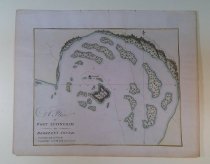
A Plan of Port Effingham in Berkeley's Sound (Cook, 1790) - Chart, Navigational
PS2025.4.401
Record Type: Archive
-
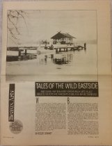
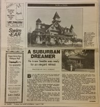
A Suburban Dreamer: He knew Seattle was ready for an elegant retreat - Newspaper
PS2016.9.83
Record Type: Archive
-
-
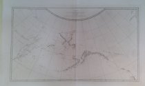
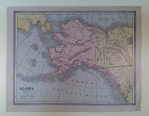
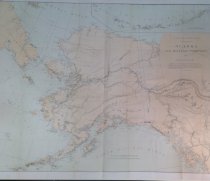
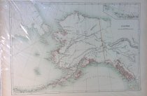
ALASKA AND ADJOINING TERRITORY. 1884. U.S. Coast and Geodetic Survey, J.E. Hilgard, Supt. Re-issued with additions in April 1884. ... Compiled by W.H. Dall;... - Chart, Navigational
PS2025.4.134
Record Type: Archive
-
-
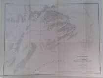
ALASKA. MILITARY EXPEDITION IN CHARGE OF CAPT. W.R. ABERCROMBIE U.S.A. PRINCE WILLIAM SOUND AND VICINITY 1898. TOPOGRAPHY BY EMIL MAHLO. - Chart, Navigational
PS2025.4.119
Record Type: Archive
-
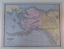
ALASKA; A Sketch Map Showing Location of Principal Towns H Rep 434 57 1 - Chart, Navigational
PS2025.4.199
Record Type: Archive
-
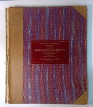
ALASKAN BOUNDARY TRIBUNAL; Atlas of Award. Twenty-five sectional Maps and Index Map showing the Line Fixed by the Tribunal - Chart, Navigational
PS2025.4.277
Record Type: Archive
-
ALASKAN BOUNDARY TRIBUNAL; BRITISH ATLAS, Maps and Charts Accompanying the Case of Great Britain - Chart, Navigational
PS2025.4.400
Record Type: Archive
-
ALASKAN BOUNDARY TRIBUNAL; BRITISH ATLAS, Maps and Charts Accompanying the Case of Great Britain - Chart, Navigational
PS2025.4.276
Record Type: Archive
-
ALASKAN BOUNDARY TRIBUNAL; UNITED STATES ATLAS, Maps and Charts Accompanying the Case and Counter Case of the United States - Chart, Navigational
PS2025.4.399
Record Type: Archive
-
ALASKAN BOUNDARY TRIBUNAL; UNITED STATES ATLAS, Maps and Charts Accompanying the Case and Counter Case of the United States - Chart, Navigational
PS2025.4.275
Record Type: Archive
-
AMERICA NORTHWEST COAST. PORT SIMPSON TO CROSS SOUND INCLUDING KOLOSCHENsK ARCHIPELAGO CHIEFLY FROM VANCOUVER'S SURVEY IN 1792. Corrected from a Russian Chart published in 1853. With corrections and additions from plans published by the U.S. Government - Chart, Navigational
PS2025.4.124
Record Type: Archive
-
AMERICA NORTHWEST COAST. PORT SIMPSON TO CROSS SOUND INCLUDING KOLOSCHENsK ARCHIPELAGO CHIEFLY FROM VANCOUVER'S SURVEY IN 1792. Corrected from a Russian Chart published in 1853. With corrections and additions from plans published by the U.S. Government - Chart, Navigational
PS2025.4.112
Record Type: Archive
-
-
-
-
-
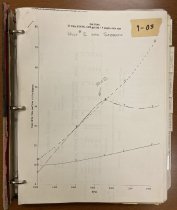
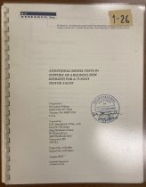
Additional model tests in support of a bulbous bow retrofit for a 75-foot motor yacht - Documents
PS2018.2.18
Record Type: Archive
-
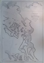
Admiral Line general orientation chart, Dixon Entrance to Icy Strait - Chart, Navigational
PS2025.4.83
Record Type: Archive
-
-
-
Alaska Alaska Peninsula and Aleutian islands to Seguam Pass - Chart, Navigational
PS2025.4.64
Record Type: Archive
-
Alaska Alaska Peninsula and Aleutian islands to Seguam Pass - Chart, Navigational
PS2025.4.107
Record Type: Archive
-
Alaska Dixon Entrance to Cape St. Elias (1912) - Chart, Navigational
PS2025.4.130
Record Type: Archive
-
Alaska Dixon Entrance to Cape St. Elias [Annotated with Fishtraps] (1919) - Chart, Navigational
PS2025.4.133
Record Type: Archive
-
Alaska - Aleutian Islands Attu Island Temnac Bay Prelininary Chart - Chart, Navigational
PS2025.4.78
Record Type: Archive
-
-
-
-
-
Alaska - South Coast, Prince William Sound, Drier Bay - Chart, Navigational
PS2025.4.220
Record Type: Archive
-
-
-
-
Alaska Steamship Company Routes and Connections. The Alaska Line - Chart, Navigational
PS2025.4.201
Record Type: Archive
-
-
-
-
Aliaska Peninsula and Adjacent Islands. To Accompany Report of Explorations of Alaskan Fishing Grounds, in Bulletin U.S. Commission of Fish and Fisheries for 1888. [C. Fairweather to Unimak Pass] - Chart, Navigational
PS2025.4.198
Record Type: Archive
-
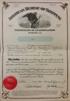
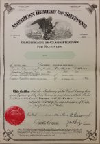
American Bureau of Shipping Certificate of Classification for Hull - Certificate, Inspection
PS2016.9.132
Record Type: Archive
-
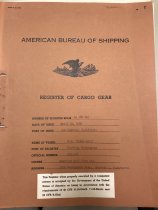
American Bureau of Shipping Certificate of Classification for Machinery - Certificate, Inspection
PS2016.9.133
Record Type: Archive
-
-
American Mail Line Ltd / United States Maritime Commission General Order No. 13 - Documents
PS2019.2.11
Record Type: Archive
-
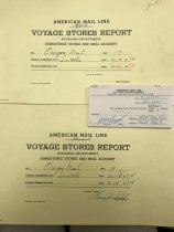
American Mail Line Voyage Stores Report Voyage 17 03-18-74 - Documents
PS2019.2.4
Record Type: Archive
-
Anchorages North Coast of Vancouver Island: Beaver Harbor, Alert Bay and Entrance to Nimpkish River - Chart, Navigational
PS2025.4.174
Record Type: Archive
-
-
Anchorages in Discovery Passage, British Columbis, Canada. Gowlland Harbor, Elk Bay, Otter Cove, Duncan Bay - Chart, Navigational
PS2025.4.257
Record Type: Archive
-
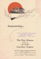
Announcing The New Mianus Model 44 - 4 Cycle - Gasoline Engine - Brochure
PS2017.1.62
Record Type: Archive
-
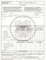
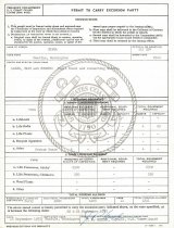
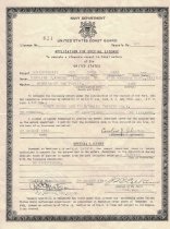
Application for Special License to operate a pleasure vessel in local waters of the United States - License
PS00.2019.2
Record Type: Archive
-
-
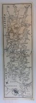
Archipelago of Arro, Gulf of Georgia, Ringold's Channel and Straits of Fuca, Oregon Territory, by the U.S. Ex. Ex. 1841 - Chart, Navigational
PS2025.4.35
Record Type: Archive
-
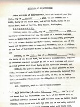
Articles of Copartnership between Joe F. Boles, owner of Harbor Island Ferries, and Irving Frank - Documents
PS1980.2.307.2
Record Type: Archive
-
-
BROWN AND EDYE PASSAGES, BRITISH COLUMBIA #USN 1764 - Chart, Navigational
PS2025.4.48
Record Type: Archive
-
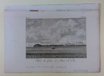
Baie de Glace et Mont Ste. Elie [Icy Bay and Mt. St. Elias], Plate XV., after Heddington - Chart, Navigational
PS2025.4.293
Record Type: Archive
-